Tokyo Subway Navigation
Tokyo has one of the most comprehensive transport systems in the world involving multiple metro lines, trains and commuter lines. Nevertheless one of the problems with this mass transit system is that it can be confusing because you need to know what time of transport are you going to use and where are you planning to go, since the fare is different based on those factors.
I remembered that the last time I visited Tokyo, I got a rechargeable SUICA card and it worked great because at least I didn't need to think about the ride fare every time. This time around I got again one of those cards as soon as I arrived to Shinjiku.
I also browsed the store to see if there was any android application to browse the transportation map easily and I found that the Tokyo Metro Company offers an official navigation app. This application enable the users to search for stations on the map and even plan a trip by defining the origin and destination stops. The application can use your current location to suggest the closest stops.
I have been using it for the last 3 days and it works great! Let me give you a practical example.
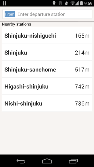
I was planning to visit the ancient Buddhist temple of Sensō-ji, located in Asakusa, later today. So I opened the application and when I click on the departure station it suggest me the closest ones:
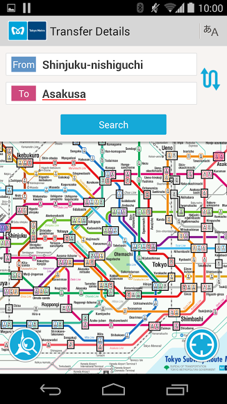
Once I define Asakusa as my destination it will show me both stations in the transit system map:
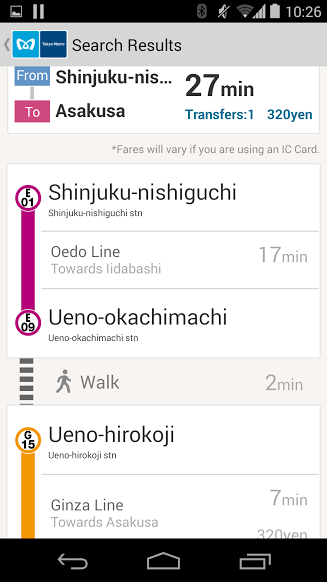
And once click on the "Search" button. It tells me the trip is going to take 27 minutes and it's going to cost me 320 yen. The apps tells me I need to take the Oedo line heading to lidabashi, get out at Ueno-okachimachi, walk for 2 minutes and then board the Ginza line towards Asakuka.
In conclusion it's a brilliant application and it's available for free in the Google Play Market.